-
Location Garhwal Himalayas
-
Duration 14 Days
-
Best Season May - June and September - October
-
Level Strenuous
-
Altitude 17,388 ft. (highest)
Tour Details
The Mayali Pass is a high pass of over 5000 meters and takes you from the Bhilangana Valley to Kedarnath and the Mandakini Valley. It falls on the legendary trek route to trek from the holy shrine of Gangotri to the holy shrine of Kedarnath – 2 of the most coveted pilgrimage destinations for the Hindus.
For those few trekkers who wants to do this legendary trek route from Gangotri to Kedarnath, the approach is via the Auden’s Col starting from Gangotri. The trek route is considered a semi technical route requiring to negotiate not just the high altitude, but most importantly the crevasses and the treacherous and deadly Khatling glacier. Once they enter the Bhilangana valley, they then meet the slightly easier Ghuttu – Mayali Pass trek route and then cross the pass to reach Kedarnath.
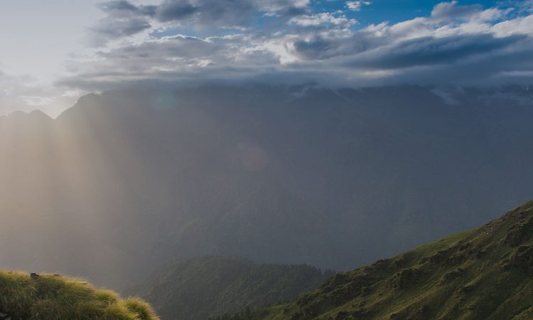
The Mayali pass trek can also be approached from the village of Ghuttu, near Uttarkashi. Comparatively, this trek is a easier one. We approach the Mayali Pass form Ghuttu passing by the villages of Reah and Gangi and then to the small picturesque medows of Kharsoli, Kalyani and then then to the grand meadow of Chowki with breathtaking views all round of some of the elegant mesmerisers of Garhwal Himalayas. A side excursion to Sahastra Tal can be added from Kharsoli.
From Chowki, the Mayali Pass Trek changes its grade and its colour too, reaching the serious high altitude zone of the Himalayas. We take some time acclimatizing and exploring this beautiful site. A side trek to explore the fear striking, crevasse filled Khatling Glacier.
The Mayali Pass trek really reveals itself from beyond Chowki where the terrain gets rougher. It then heads towards the mighty Mayali Pass getting tougher, steeper, passing through the treacherous boulder laiden terrain from Masar Tal, Masar Top and then to the top of the Mayali Pass. Snow and most importantly – thin layers of ice on these type of terrain can make things really tricky and having a safe step, basic set of equipment and a good knowledgeable guide who knows the terrain well, is very much advised . You also need to be well equipped with all necessary gears to negotiate such terrain depending on the season and the condition of the terrain when you are doing this trek.
The descend from the top of Mayali Pass is sharp and climbs down to the pious lake of Vasuki Tal ( not to camp by the lake ). This terrain is too boulder-laiden and eases out gradually. From Vasuki Tal, the trek eases out comparatively to get us to the holy shrine of Kedarnath.
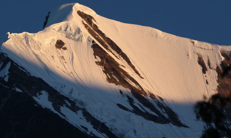
If we like to trek in the wild, away from the rush and crowded trails, this is one of the best option for you. The villages on this trail give you an insight of the local culture. The twin holy lakes of Masar Taal and Vasuki Taal will leave you silent and peaceful. The sight of crevasse filled Khatling glacier might leave your spines chilled. Achieving the top of Mayali Pass and views from the top will leave you ever excited whenever you speak of this trek to others.
This trek is not an easy one and a good physical fitness and mental stamina is much required. Previous experiences help, as often the weather God might show its agony and your plans might fall apart.
Itinerary
Day 1
Rishikesh to Ghuttu -145km drive – h-2524m
Day 2
Ghuttu to Reeh - 10km trek h- 2132m
Day 3
Reeh to Gangi -12km trek - h-2584m
Day 4
Gangi to Kalyani -12km trek - h-2683m
Day 5
Kalyani to Kharsoli -10km trek
Day 6
Kharsoli to Khatling Cave - 12km trek
Day 7
khatling Cave to Khatling glacier- back khatling cave 12km trek h- 3718m
Day 8
Khatling Cave to tamakund /chowki - 16 km trek
Day 9
Chowki to masartal -10km trek h-4590m
Day 10
---------------------- Acclimatization
Day 11
Masartal to Myalipass - hight-5400m to vasukital 13km hight-4880m
Day 12
Vasukital to Kedarnath - 10 km trek hight 3584m
Day 13
Kedarnath to Gaurikund -14km trek then drive for rudraprayag 130km
Day 14
Rudrapryag to drive for - haridwar 150km
 Yashaswi Himalayas Trek


